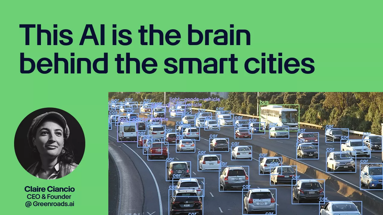
In this Charging Stack podcast episode, we talk with Claire Ciancio, Founder & CEO of GreenRoads.ai, a Malta-based startup turning everyday traffic video into real-time insights for safer, cleaner, and more efficient streets.
GreenRoads.ai uses computer vision to classify road users (cars, buses, pedestrians, cyclists, scooters, commercial vehicles), track trajectories, measure speed and congestion, and surface safety risks like conflict zones and unsafe crossings. The key point: it works with infrastructure cities already have, including existing roadside cameras and drone surveys for complex junction studies. Claire also breaks down the privacy-by-design approach, including GDPR realities and why the platform focuses on anonymous mobility patterns, not identifying people.
Prefer reading instead of listening? Check out our GreenRoads.ai deep dive article for the product breakdown, use cases, and where this fits in the smart city stack.
You work in city mobility, road safety, or transport planning
You manage traffic operations, parking policy, or public space redesign
You build mobility products and need better “what’s actually happening on the street” data
You care about privacy-safe analytics that can still drive real change
In this episode, you’ll learn:
⚡ Why “lack of quality data” is still the hidden blocker for city transport decisions ⚡ How AI video analytics turns cameras into live traffic intelligence without new hardware installs ⚡ What cities can measure beyond vehicle counts: pedestrians, bikes, scooters, conflict points, and crossing behaviour ⚡ When drones beat fixed cameras for quick studies and messy junctions ⚡ How privacy and GDPR are handled when video is involved, and what “privacy-by-design” looks like in practice ⚡ What’s next: better multi-camera tracking, GIS mapping, and more detailed origin-destination insights
Topics covered include
Why manual counting and gut-feel planning still shows up in major infrastructure decisions
Measuring dangerous crossings and pedestrian flow, and using that data to justify changes
Congestion analytics basics: dwell time, speed, capacity, and how patterns shift over time
Turning “before vs after” pilots into credible evidence for hard policy calls
The practical setup: connecting live camera feeds (RTSP), fast onboarding, and dashboards vs API integrations
What happens in bad weather or low-quality footage, and where computer vision hits real limits
How cities, planners, researchers, and private operators (ports, toll roads, campuses) use this kind of data
Expansion goals and why this approach can scale globally without on-site installs
Subscribe to Charging Stack for more podcast episodes, deep dives, and case studies with the people keeping the future of mobility running. ⚡
Share your love
Filip Bubalo
Researcher & writer for Charging Stack. Marketing manager at PROTOTYP where I help mobility companies tell better stories. Writing about the shift to electric vehicles, micromobility, and how cities are changing — with a mix of data, storytelling, and curiosity. My goal? Cut through the hype, make things clearer, and spotlight what actually works.